
Fix My Street
Overview
“Fix My Street” application was first launched in 2017 for enabling citizens to directly connect with concerned ward engineers and elected representatives to resolve the problem of potholes. It’s bi lingual mobile app available on android mobile platform. Besides reporting potholes related complaint, Fix My Street can be used for registering any civic amenity issues such as street light and garbage.
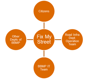
Organization, Stakeholder and User Mapping
Benefits to Citizens
- Helps for reporting a civic amenity issues with a photo ( geo-tagged)
- Allows citizens to get notification on SMS about the submission and progress
- Provides a provision to submit requests with or without registration
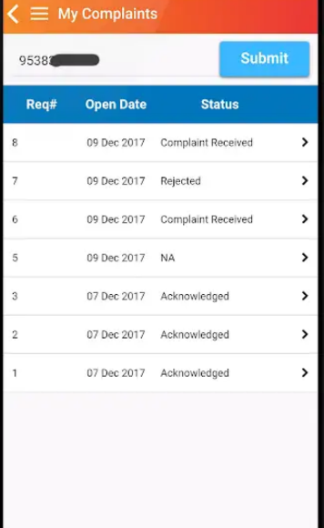
- Provides a dashboard of all complaints at along with details latest of updates on complaints
Benefits to BBMP Officials
- Citizen requests are geo-tagged to maps of concerned ward official which helps in easy view for concerned officials
- Concerned officials get immediate notification along with citizen request details
- Department officers have access of all complaints in a dashboard which helps them understand the status at macro level
- Officials get a provision of updating the work done status along with photo. This helps in quick visibility of work done to all
- Department level dashboard allows to monitor all requests and helps in driving everyone towards actions of attending and resolving complaints
- BBMP officers also get an option of transferring a request to another ward or department
Application Workflow
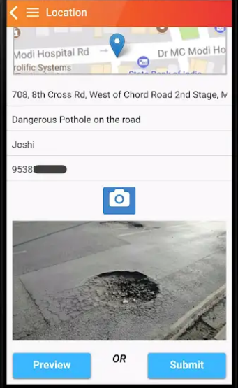
The mobile application has simple easy to use workflows for capturing and reporting problems related to civic amenities like Pothole, Garbage, Streetlight and other categories. Citizen has to click the image of the issue, and details of location is captured automatically however, a land mark needs to be shared. The issue is then reported to concerned engineer for corrective action.
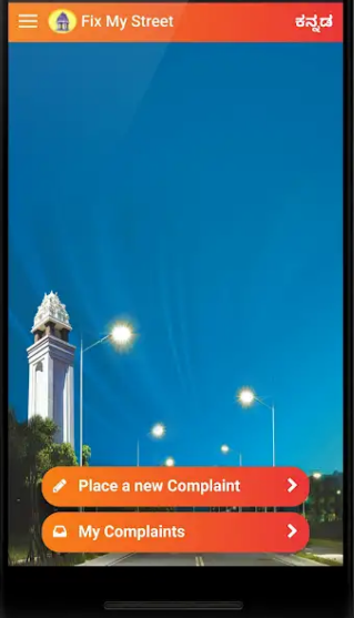
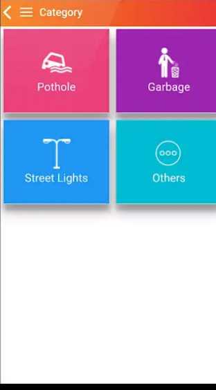
Snapshots of Fix my street portal
- The simple workflow of snap, capture and report makes the application user friendly
- Pothole location is automatically captured through GPS feature of phone and additionally the user gets the option of adding landmark to the pothole for easy recognition and resolution
- Citizens reporting the pothole also get an option of asking friends, neighbors and other citizens affected by pothole to vote up, comment and form a group. This helps in civic participation and gives ideas to civic agencies for finding quick solution to resolve the issue
- The citizen can also see the status of reported pothole, whether the repair work is approved, and the app also gives the likely completion of pothole filling with along with details of date and time by which the pothole is filled